Our Approach
Luminescence Dating
Luminescence Dating
Uncovering the Past Through Scientific Dating
Every site holds clues to its history. Through field sampling and laboratory analysis, we use Optically Stimulated Luminescence (OSL) to estimate the age of sediments and help reconstruct their depositional history.
Our approach combines fieldwork, laboratory analysis, and scientific interpretation, transforming samples collected directly from project sites into valuable chronological information about the contexts we investigate.
Step 1: Field Sampling
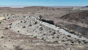
Every analysis begins in the field. Based on the characteristics of the site and the objectives of the investigation, we identify suitable sampling locations and collect sediment samples appropriate for OSL dating.
Particular care is taken to protect samples from light exposure, which is essential for preserving the luminescence signal required for reliable dating.
Step 2: Laboratory Analysis
Once collected, the samples are prepared and analysed in the laboratory using specialised procedures. Through OSL, we measure the light-sensitive signal stored in mineral grains within the sediment, particularly quartz and, where appropriate, feldspar.
These measurements allow us to determine the radiation dose accumulated by the minerals over time, providing the information needed to estimate the age of the sample.

Step 3: Results and Interpretation
The laboratory measurements are processed and interpreted in relation to the characteristics of each sample and its geological or archaeological context.
The result is an age estimate, together with its associated uncertainty, which can be integrated with other geological, archaeological, or environmental evidence to help reconstruct the history of the site.
Acquisition and analysis of geological and geophysical data
We acquire, analyze, and map complex geological and geophysical data to deliver precise spatial insights for every project.
Environment-Specific Drones: We deploy tailored drone fleets, from fixed-wing UAVs for vast terrains to high-stability multirotors for landslides and marine environments.
Sampling & Data Processing: Using different sensors, we collect targeted environmental data, integrate ground sampling, and process raw measurements into high-precision dataset models.
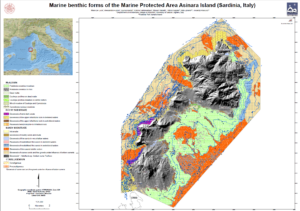
Mapping & Digital Outputs: We transform data into actionable GIS deliverables, including high-resolution orthophotos, and structural geological maps.